Simon King Lead Weather Presenter
- 17 November 2025, 11:57 GMT
- 159 Comments
Updated 28 minutes ago
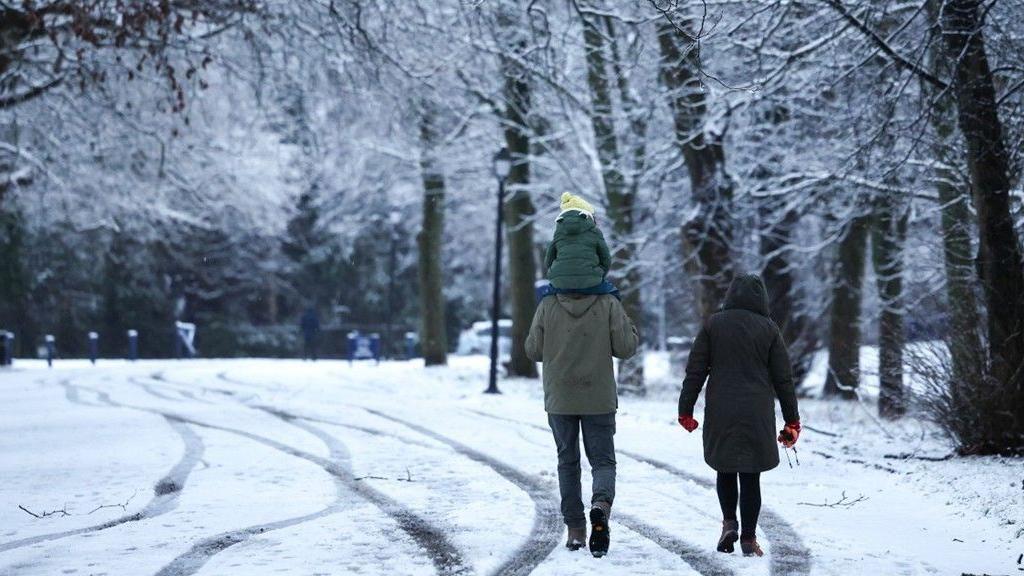
Arctic air has spread across the United Kingdom as temperatures drop with the threat of snow and ice for some.
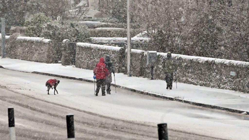
Met Office yellow severe weather warnings for snow and ice have been issued across Scotland and northern England on Tuesday.
There are also amber and yellow cold-health alerts, issued by the UK Health Security Agency (UKHSA), valid until Friday across northern England and the Midlands.
It will turn less cold by the end of the week.
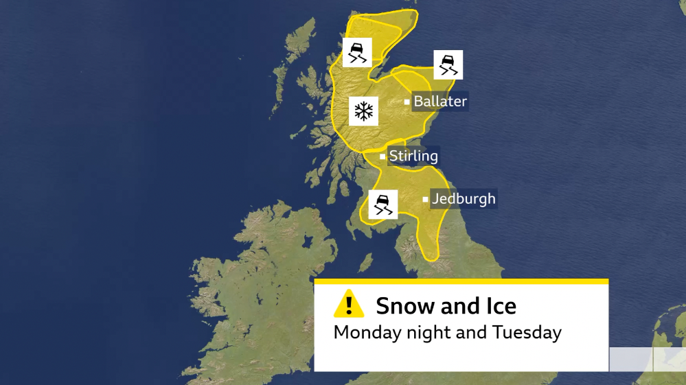
Snow and ice yellow Met Office warnings for Monday night into Tuesday
November has so far been exceptionally mild with temperatures 3-6C above average.
But that has now changed as a northerly wind is dragging cold Arctic air across the UK with temperatures now falling 3-6C below the mid-November average.
Yellow cold-health alerts from the UKHSA are in force across the Midlands and northern England until 08:00 GMT Friday.
But more severe amber alerts have been issued for North West, North East, Yorkshire and Humber for the same period.
These alerts are mainly for health and social care services, warning of “significant” impacts to more vulnerable members of the community.
Extra demands may be put on services to deal with the colder weather.
The cold weather leads to excess deaths, particularly those over 65 or those with health conditions. The UKHSA also warns there maybe impacts to some younger age groups too.
-
How to drive in snow and icy weather
- 6 January
Rain is forecast to spread south and east across the UK on Monday night and Tuesday, with the air is cold enough for this to turn to snow for some.
A yellow weather warning for snow has been issued for northern and eastern Scotland starting at 03:00 GMT on Tuesday and valid until 18:00.
There could be as much as 5-10cm of snow accumulating over the highest ground (above 400m) but even down to lower levels 2-5cm is forecast.
The snow could make some higher routes impassable and there could be some disruption to rail journeys.
During Tuesday there could also be hill snow in the North Pennines and the North York Moors.
Ice will also be a hazard with additional Met Office yellow warnings issued for northern and eastern Scotland – valid from 19:00 Monday to 10:00 GMT Tuesday.
An ice warning is also issued for central Scotland and down to northern England from 05:00 to 12:00 GMT Tuesday.
Further frequent and heavy snow showers will spread into northern Scotland overnight Tuesday, even to sea level. These will continue right through until Thursday.
With snow accumulating, another Met Office warning for snow and ice is in force for northern Scotland from 18:00 GMT Tuesday to 21:00 Thursday.
Frequent snow showers may bring 2-5cm to low levels but as much as 15-20cm is possible above 300m.
Gusty winds and lightning with the snow may bring additional hazards.
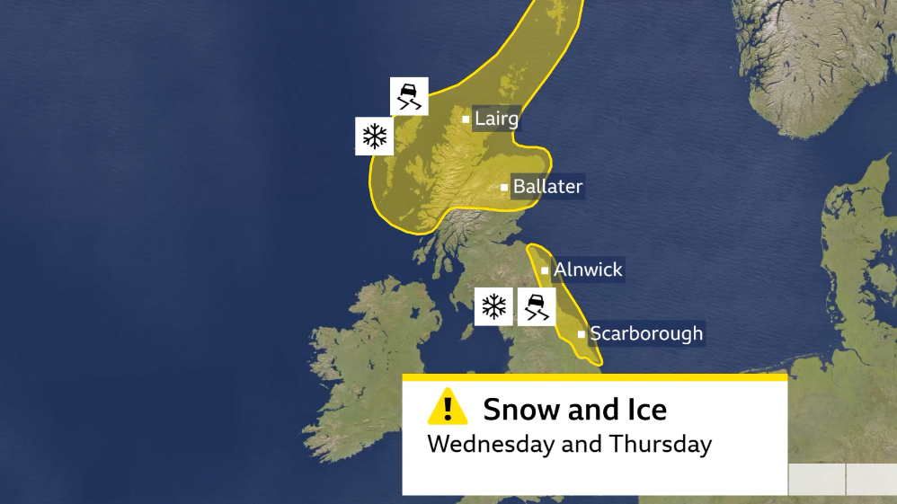
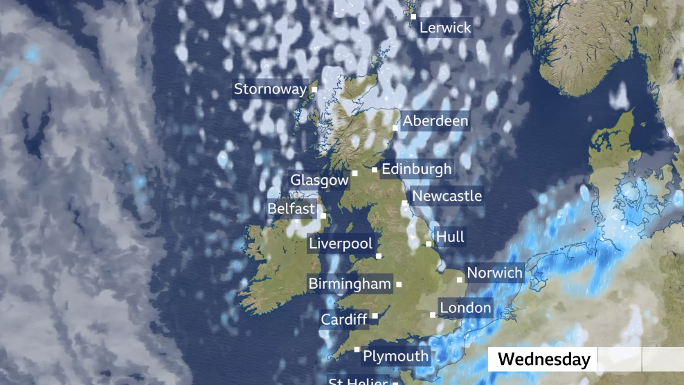
Additional Met Office yellow warnings come into force on Wednesday and Thursday as snow and ice threat continues
The cold northerly wind on Wednesday will blow in snow showers across mostly northern Scotland but also for a time in Northern Ireland, eastern England, west Wales and even the Moors of south-west England.
Some of these snow showers could be heavy with thunderstorms – known as ‘thundersnow’.
Another Met Office yellow warning is in force for snow and ice in coastal areas of eastern England valid 06:00 GMT Wednesday until 18:00 Thursday.
Where the snow showers come in frequently from the North Sea, some areas may get 2-5cm at low levels.
But over hills above 300m, up to 20cm of settling snow is possible.
As temperatures fall below freezing overnight, ice will form.
Frequent snow showers will come into parts of the UK on Wednesday on a brisk northerly wind
How cold will it get?
From Wednesday it will feel especially cold for most of us with temperatures of 2-5C but feeling more like minus 2 to 4C when you’re in the wind.
There will be some overnight frosts and risk of ice where showers fall.
Thursday night will be the coldest night this week with temperatures widely falling below zero and down to -12C in rural Scotland.
While Friday will start as the coldest morning of the autumn so far with lots of sunshine, we’ll start to see a shift away from the cold northerly wind.
An Atlantic weather system will slowly come in from the west bringing more cloud and bit of rain and less-cold air.
Temperatures by Saturday will rise slightly to average. So while it won’t feel as mild as it was last week, it won’t be as cold as much of this week will be.
-
- 3 January

-
- 2 December 2020
0:47